

Problem Framing and Scope
The second stage of the DSP. It takes the baseline understanding produced by Asset / Network Evaluation and turns it into clearly articulated transport problems, then generates candidate interventions against them.
The four stages
The process comprises four main stages, guided throughout by the System Interdependencies module.
| Stage | What it produces | |
|---|---|---|
| 1 | Understanding context and drivers | A shared understanding of the system, its drivers, constraints and uncertainties |
| 2 | Problem definition | Macro-level and spatially specific problem statements |
| 3 | Identifying problem impacts | The consequences of each problem, across system levels |
| 4 | Ideation of intervention | A long list of candidate interventions |
Together these establish the geographic scope, temporal horizons, and required service or performance levels.
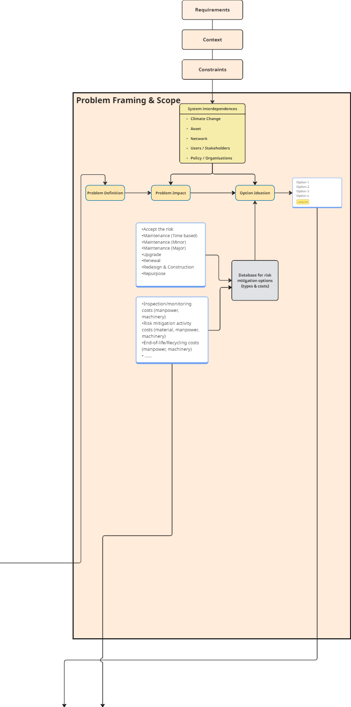
Figure 1. The Problem Framing and Scope technical process.
Stage 1: Understanding context and drivers
The stage begins by developing an understanding of the context within which the system operates, typically through a co-creation stakeholder workshop that builds a shared understanding by identifying key drivers, constraints, requirements and uncertainty.
This lays the foundation for the initial scope of the transport case. It may involve:
- Mapping drivers and context, current and future, using a co-creation process to identify the drivers for the transport case
- Gathering stakeholder plans, data and models, to establish what is already available, what is already known about the system, and where the uncertainties are
- Understanding the challenges influencing the current and future transport system, captured through multiple stakeholder perspectives: development pressures, transport and mobility issues, and social, environmental and climate concerns
The gameboard
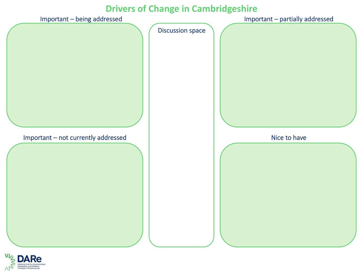
Figure 2. A gameboard used in a collaborative activity to identify, discuss and prioritise the most important drivers of future change that could shape transport systems.
Drivers of change cards
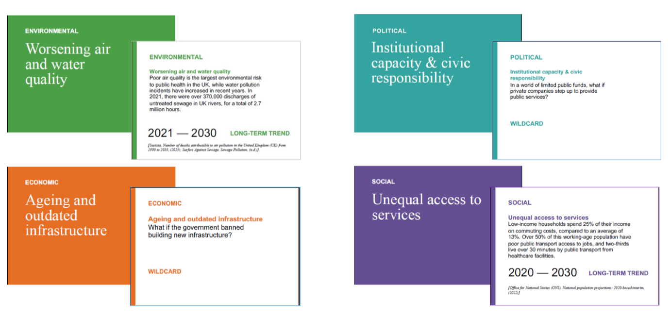
Figure 3. Drivers of Change cards from the Foresight full deck, alongside additional cards developed for the project to capture transport-specific trends, uncertainties and challenges.
The deck was extended for this purpose
The workshop uses the Foresight Drivers of Change deck, supplemented with cards written specifically for the project to capture transport-specific trends, uncertainties and challenges.
Using an established deck gives breadth that a room of transport specialists would not generate unprompted. Adding project-specific cards keeps it relevant.
Capturing stakeholder perspectives
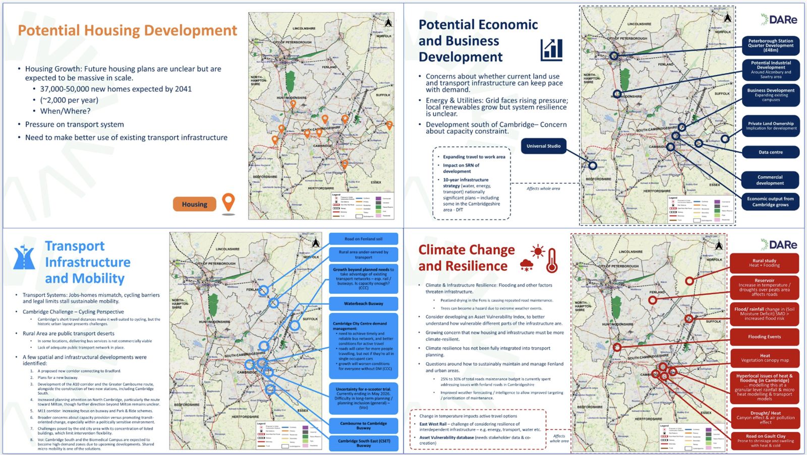
Figure 4. A collaborative co-creation activity to capture transport challenges from multiple stakeholder perspectives.
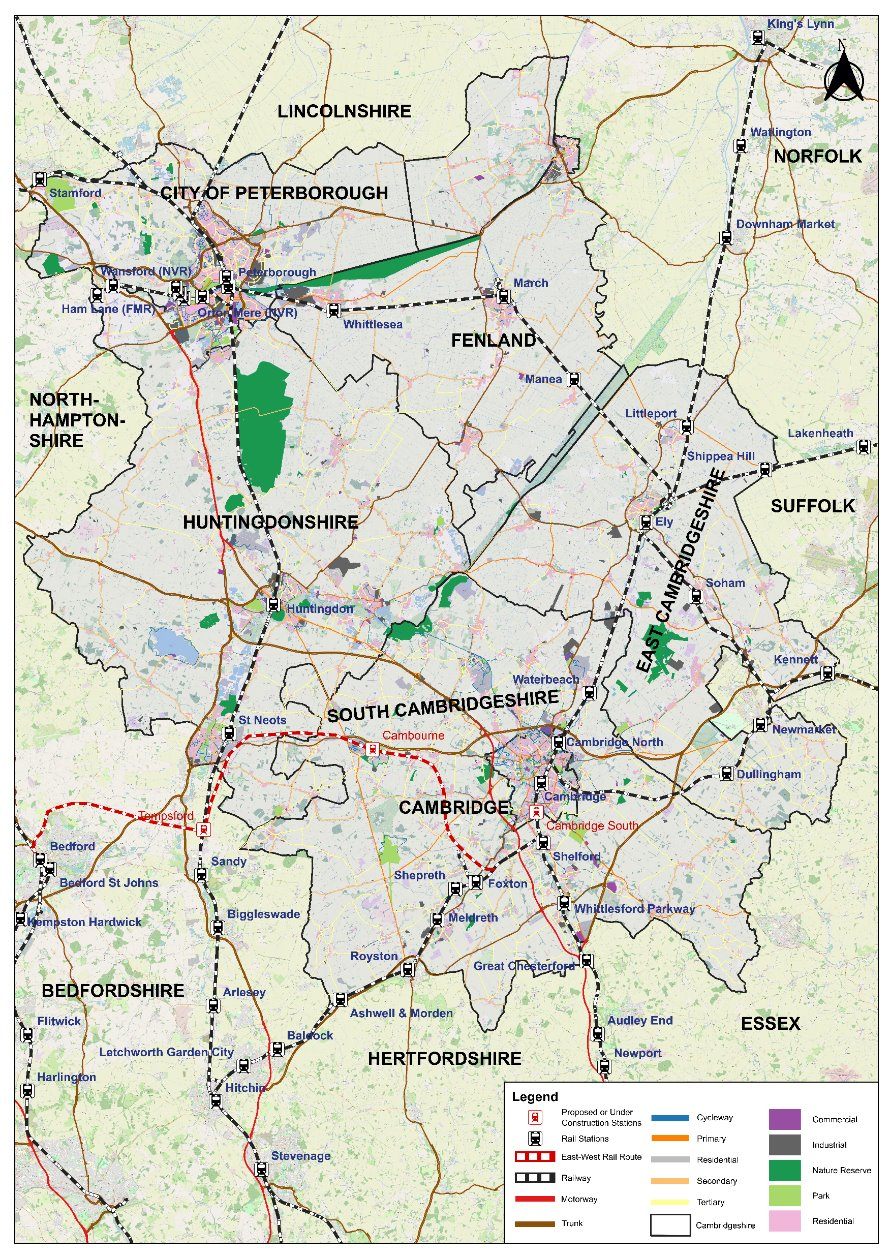
Figure 5. Annotated maps from the same activity.
The activity is structured around a set of prompts. Participants discuss and document on the maps:
What does the future look like?
- Housing
- Climate change
- Economic development
- Social and environmental issues
Then:
- What are the implications of this for our transport needs and transport infrastructure?
- How can these challenges and opportunities be addressed?
Stage 2: Problem definition
Problem statements translate identified vulnerabilities, risks and system challenges into clearly articulated transport problems.
Two levels of statement
| Level | What it represents |
|---|---|
| Macro-level | Strategic transport challenges associated with one or more vulnerability vectors |
| Spatially specific | Critical hotspots, disaggregated from the macro statements |
The progression between them is driven by evidence: as understanding of risks and system criticality improves, macro-level statements can be broken down into spatially specific ones.
This may be achieved through co-creation stakeholder workshops, stakeholder interviews, and transport and climate modelling. It may involve:
- Mapping transport system criticality of various modes or routes, under current and future contexts, through stakeholder engagement
- Identifying resilience requirements of various modes or routes, current and future
- Mapping wider system impacts or consequences on the critical modes and routes
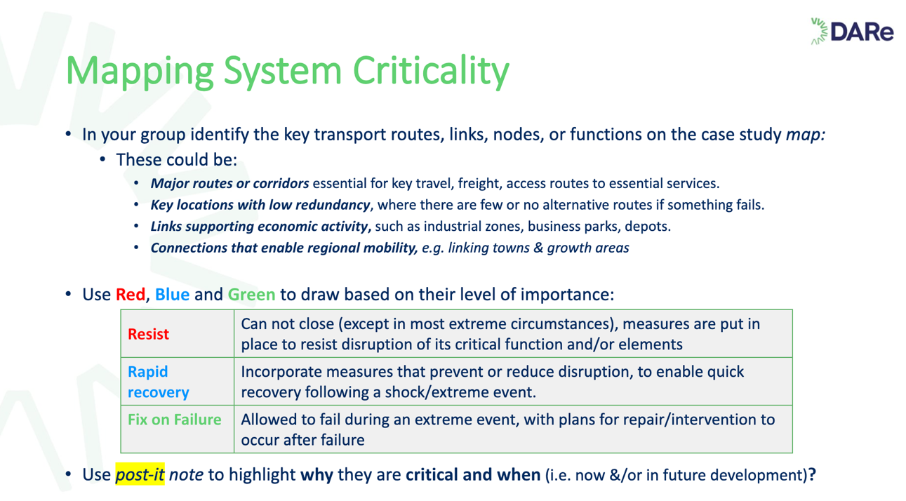
Figure 6. Mapping system criticality and level of importance.
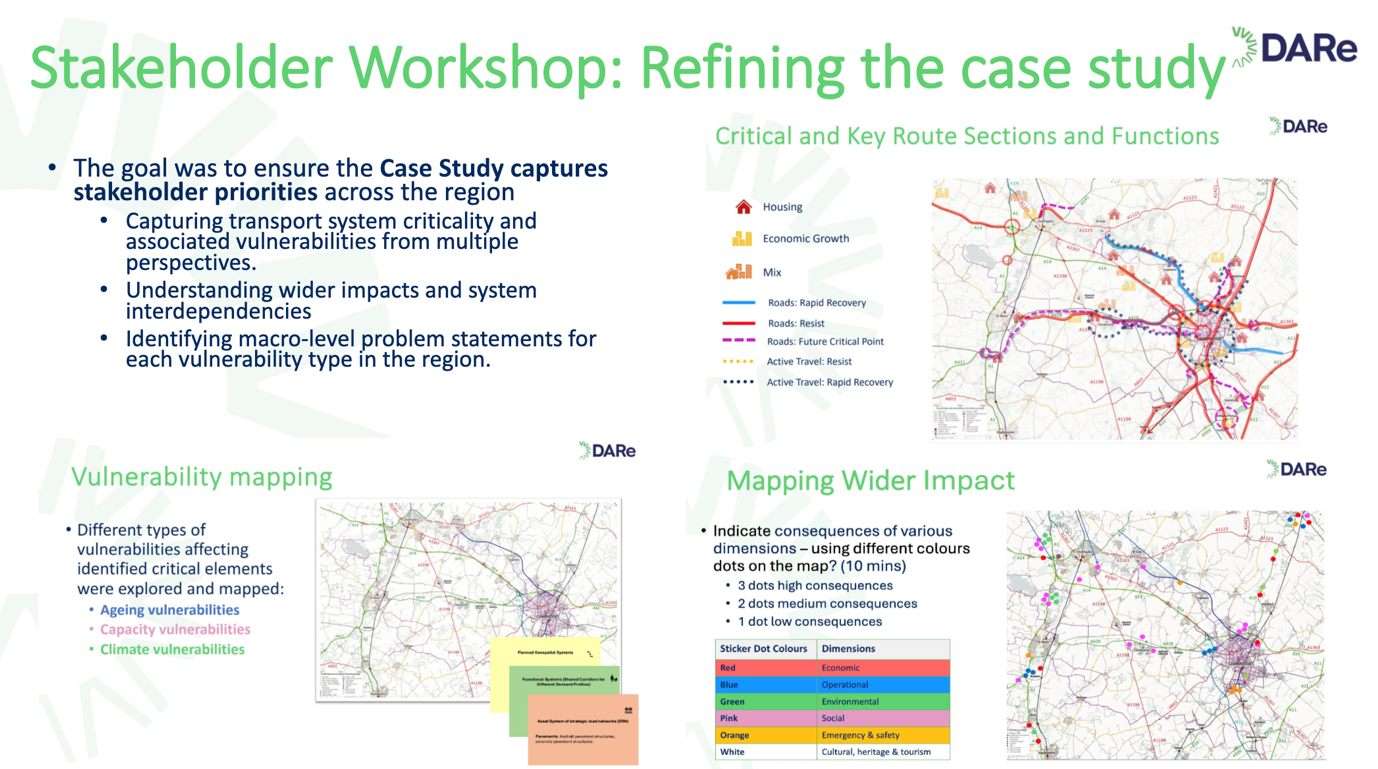
Figure 7. A case study workshop supporting the identification of macro-level problem statements.
Problem definition with risk: the vulnerability hotspots approach
A three-step method for locating where problems actually bite.
Step 1: Overlay vulnerability vectors
Overlay the different vulnerability vectors to identify where vulnerabilities occur across the network.
Step 2: Identify vulnerability hotspots
This focuses attention on hotspots, particularly where multiple vulnerability vectors overlap.
Hotspots are scale-agnostic
A hotspot may be large, for example roads across north Cambridgeshire vulnerable to a particular hazard. Or it may be highly localised: a specific junction, village, road link, or flood defence.
The method does not presuppose a scale. What defines a hotspot is the concentration of vulnerability, not its size.
Step 3: Consider change over time and wider interactions
Assess how vulnerabilities and hotspots evolve over time, and how they intersect with other important features such as hospitals, critical routes, and areas of high deprivation.
What this means for interventions
Where multiple vulnerability vectors overlap, interventions may need to be assessed against several vulnerabilities rather than a single hazard. An option that solves for flooding alone may be the wrong option for a hotspot that is also heat-exposed.
Two open issues the source flags itself
Defining hotspot criticality. The handbook labels this explicitly as a gap. How to define the criticality of a hotspot, for example in terms of its impact on transport performance and other consequences, is not resolved.
Order of events is not accounted for. An author note records that this approach does not capture impacts increasing because of the sequence of events, giving the example of drought followed by rain increasing flood severity. The note asks whether this belongs in the Resilience module instead.
Both are unresolved questions for the authors, not settled method.
Stage 3: Identifying problem impacts
Once problem statements exist, at macro or spatially specific scale depending on the scope and complexity of the transport case, their implications are explored by identifying impacts across different transport system levels.
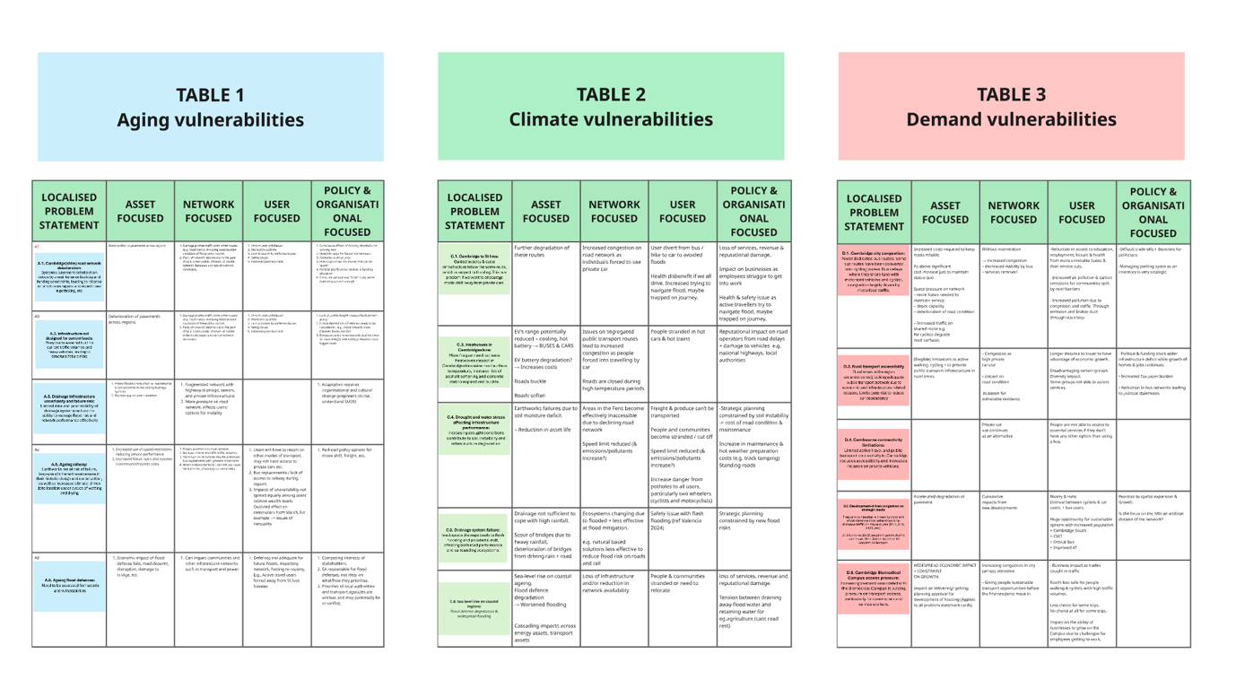
Figure 8. Identifying impacts associated with each spatially specific problem statement.
Stage 4: Ideation of intervention
Intervention ideation explores potential responses to the identified problem statements and their associated impacts. It may involve:
- Generating interventions through stakeholder workshops and co-creation exercises
- Drawing on existing adaptation and mitigation options
The capture template
Interventions are recorded against each spatially specific problem statement, and sorted by the system level they act on:
| Spatially specific problem statement | Asset | Network | User | Policy |
|---|---|---|---|---|
Why the four columns matter
Sorting interventions by system level, rather than listing them flat, makes it visible when every proposed response is a physical fix to an asset. Network, user-side and policy responses are frequently cheaper and faster, and a blank column is a prompt to look for them.
The four columns match the system categories used by the System Interdependencies module.
Figure 9. A template to capture interventions associated with each spatially specific problem statement.
Engagement required
Empty in the source
The section headed "Interviews, workshops, desk studies, and data collection required" is a heading with no text beneath it.
In practice the stage descriptions above are workshop-led throughout, and the co-creation activities, gameboard, cards and templates shown in the figures are the engagement method. The comparable section for Asset / Network Evaluation is written out in full and gives a useful model for what this one would contain.
Iterative steps
The source text here belongs to a different section
The content under "Iterative steps within the process" in the source handbook does not describe iteration in problem framing. It describes the upstream and downstream dependencies of the Risk Mitigation Module, beginning "The Risk Mitigation Module is a multi-stage decision module."
It appears to have been placed here in error. Because it is substantive material about a module that otherwise has no section of its own, it has been preserved rather than discarded, and is reproduced under Risk Mitigation where it belongs.
The iterative steps for problem framing were never written.
The purpose section is also misplaced
The source's "Purpose of the process" section for this stage lists three activities: define the mitigation objective, generate mitigation options, and consider interdependencies.
These describe risk mitigation and option generation, not problem framing. They are covered by Risk Reduction Analysis and Risk Mitigation. The purpose of problem framing, as this page presents it, is drawn from the stage descriptions themselves, which are unambiguous.
Output schema for the next process
| Activity | Key outputs | Input to next process |
|---|---|---|
| Understanding context and drivers | Agreed system scope; key drivers of change; stakeholder priorities; constraints; uncertainties; existing evidence, plans and datasets | Basis for identifying critical functions, vulnerabilities and resilience requirements |
| Understanding criticality and wider impacts | Critical transport modes, routes, assets and services; resilience requirements; wider system consequences and interdependencies; agreed vulnerability vectors | Supports identification of critical locations and vectors as part of risk analysis |
| Developing problem statements | Macro-level and spatially specific problem statements describing transport challenges and critical hotspots | Provides a structured set of transport problems for selection and impact identification |
| Prioritisation of problem statements (optional) | Prioritised set of problem statements, expressed in a risk-based way | Focuses subsequent analysis on the most significant transport challenges |
| Identifying system impacts | System impacts associated with the selected problem statements | Provides the basis for intervention generation and understanding cross-system implications |
| Intervention ideation | Long list of candidate interventions across system levels; mappings of interventions to problem statements and impacts | Provides intervention options for subsequent risk reduction analysis |
The long list produced here is what Risk Reduction Analysis screens down to a short list.